Saturday, March 29, 2008

Destination #9: Rio de Janeiro, Brazil


We're off to the second largest city in Brazil, Rio de Janeiro! Located on the coast, Rio is known for its beautiful natural setting with beautiful beaches, majestic mountains, and even the two largest forests in the world located inside an urban area. The city was the capital of Brazil for almost two centuries--from 1763 to 1822 while it was a Portuguese colony and from 1822 to 1960 as an independent nation. Rio is thriving with culture, making it a hot spot for tourism.


Here are a couple of nice videos that give a good glimpse of Rio. The first one is from 1936!!

And now for a more modern look.


Now for a bit of Brazilian culture, here's a video of a Capoeira performance. Capoeira is a Brazilian martial art that has distinct dance-like playfulness. In fact, it is common to refer to it as "playing" capoeira. Enough talk, take a look!


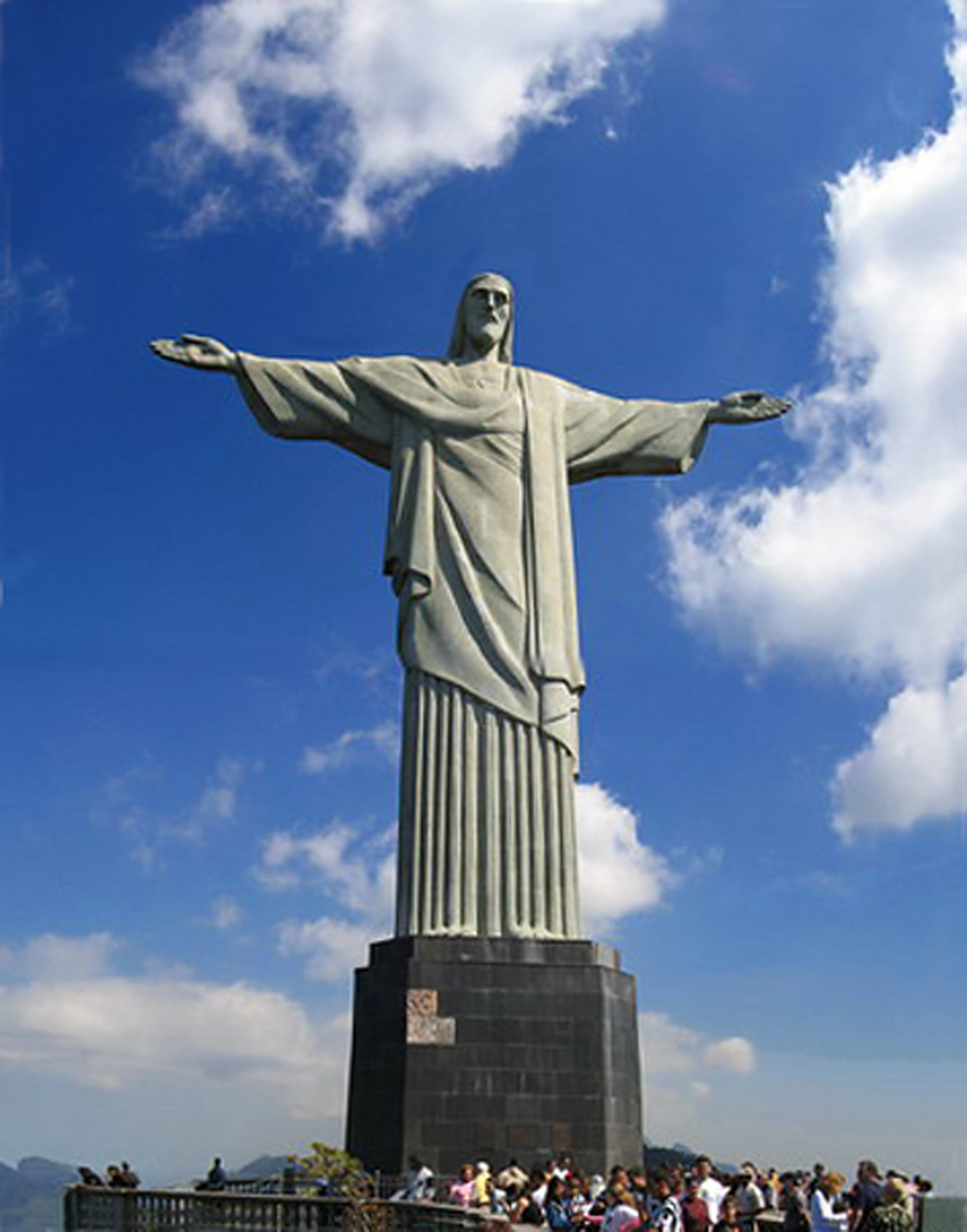
And last for the video department is a helicopter ride to Corcovado Hill, where the world famous Christ the Redeemer statue is located.


The statue has recently been declared one of the New Seven Wonders of the World. It deserves some photos, I'd say.


Having trouble finding webcams that are actually working...here is the best website I could get. It offers several traffic cams but unfortunately, it's all in spanish, so it's hard to navigate.

Wednesday, March 26, 2008

Trip #8- Easter Islands


Easter Island also known as "Rapa Nui" and "Isla de Pascua” (in Spanish) is a Polynesian island in the southeastern Pacific Ocean, at the southeastern most point of the Polynesian triangle. The island is an overseas territory of Chile. Easter Island is famous for its monumental statues, called moai, created by the Rapanui people.


The Moai statues is what the Easter Islands are most famous for. There is a total of 887 monolithic stone statues. Sometimes the statues have been identified as “Easter Island heads,” but the statues are actually complete with torsos and all. The statues are kneeling on bended knees with their hands over their stomach. However, they have been buried up to their necks by shifting soils.


I found a website that you can visit the sights in 2-D or 3-D. BUT you need 3-D glasses to see the images which can be a bummer is you don't have any. I do have a pair of 3-D glasses and this website is amazing to look at. So take a look even. Click Here.


No one really knows the true story of how the Moia statues got there. I found a Short Story of how came to stand today.

Wednesday, March 5, 2008

Destination #7: Nairobi, Kenya

photo by george mulala

Heading off again, this time to Nairobi, the capital and largest city of Kenya!


Kenya only gained its independence (from Britain) in 1963 and since then the capital, Nairobi (originally founded in 1899) grew quite rapidly. Nairobi is the 4th most populous city in Africa and one of the foremost cities in terms of politics, economics and culture. Located on the Nairobi River, the city's name comes from the phrase Enkare Nyorobi, which translates to "the place of cool waters". The city has also garnered the nickname "Green City in the Sun." Nairobi sees two rainy seasons throughout the year but for the most part, residents enjoy beautiful sunshine and comfortable temperatures (with highs averaging about 75°F year round). Sounds AWESOME to me! Nairobi is also well known for its large amount of parks and green space, which is really quite amazing compared to most modern cities. Here's a picture of the biggest park, Uhuru Park, which is often used as a gathering place for events of all kings


Nairobi is a cosmopolitan city and a thriving center for the literature, film, music and art. It has also been called the "Safari Capital of the World" because that tends to be the number one tourist draw. Tourist draw, eh?! Count me in! Nairobi National Park is a massive nature reserve located right next to the city. You can actually see the city from the park!


^AWESOME PICTURE!!!!!


Check out this hilarious video chronicling the safari adventure of a group of silly American tourists!


Some more quick videos of animals!


AMAAAAAZING VIDEO ALERT:


Ok, enough with all the videos. Let's finish up with some webcams! Well, unfortunately, there don't seem to be very many webcams...but here is one that is okay. It shows us Mount Longonot, about 60 kilometers outside Nairobi. And you can take a peak (get it, "peak?!") at some of the highlights the camera has managed to capture here.

That's it for this edition! Check back soon!

Destination #6: Punta Arenas, Chile


For our next stop in our trek across the globe, we head south (WAAAAY south) to the planet's southern most city, Punta Arenas, Chile!


Punta Arenas (Spanish for "Sandy Point") is located on the Strait of Magellan way down on the southern tip of South America. Magellan, of course, was the 16th Century explorer who led the first ever expedition to circumnavigate the globe (though he himself died in battle before his crew returned to Europe).


This memorial in Punta Arenas pays tribute to the great explorer and there is a tradition among sailors to kiss the statue when crossing the strait.

Before the building of the Panama canal, Punta Arenas was Chile's most important port. Today however, it has evolved into a modern city with a thriving tourism industry. Punta Arenas is a popular stop for cruise ships and also one of the main jumping-off points for scientific expeditions to Antarctica.


Punta Arenas is famous for some amazing sights for nature lovers! You can go check out some penguins on nearby Magdalena Island:


Or maybe take a trip to Torres del Paine National Park (take the time to explore this super cool website!) to see some amazing wildlife or take in the breathtaking mountains:


And finally we have some pretty neat webcams to look at! First up is Patagonia Webcam which gives a nice view of the mountains and sky near Punta Arenas.

And second we have a really fantastic Beluga Whalecam that let's us take a look at some friendly Beluga whales that congregate near the main dock in Punta Arenas!

Wow, I've never even heard of Punta Arenas before today, but I gotta say, it seems like an awesome place!

Monday, March 3, 2008

Trip #5: Ireland

I thought since St. Patrick's Day is coming up soon that I would travel to Ireland with week.
Ireland is the third largest island in Europe and the twentieth-largest island in the world.


Geography
Location Western Europe
Area 84,412 km² (32,591 sq mi)
Highest point Carrauntoohil 1,038 m (3,406 ft)
Administration
Flag of Ireland Ireland
Largest city Dublin
Flag of the United Kingdom United Kingdom
Constituent part Northern Ireland
Largest city Belfast
Demographics
Population approximately 6 million (as of 2007)
Indigenous people Irish


The population of the island is slightly over six million (2007), with 4.34 million in the Republic (1.7 million in Greater Dublin) and an estimated 1.75 million in Northern Ireland (0.6 million in Greater Belfast). This is a significant increase from a modern historical low in the 1960s, but still much lower than the peak population of over 8 million in the early 19th century, prior to the Irish potato famine.

Here is a quick overview of Ireland


These are pictures of Ireland's country side. This is Giant's Causeway


Killarney National Park


Blarney Castle

Slieve League cliffs